11K 360° Vision
Crystal-clear Insta360 Titan reality capture.

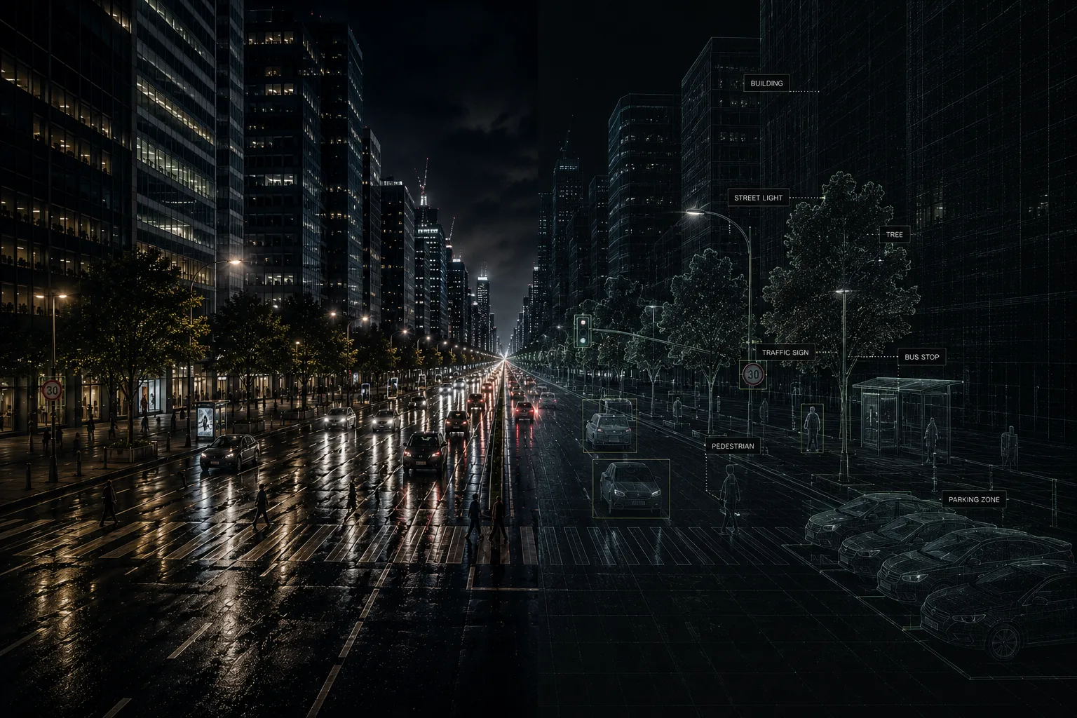
High-fidelity terrestrial digital twins powered by 11K Insta360 Titan imaging, high-density mobile LiDAR, and custom AI infrastructure models.
Crystal-clear Insta360 Titan reality capture.
Centimeter-level accuracy at traffic speed.
Automated infrastructure and road analytics.
Living semantic maps for modern cities.
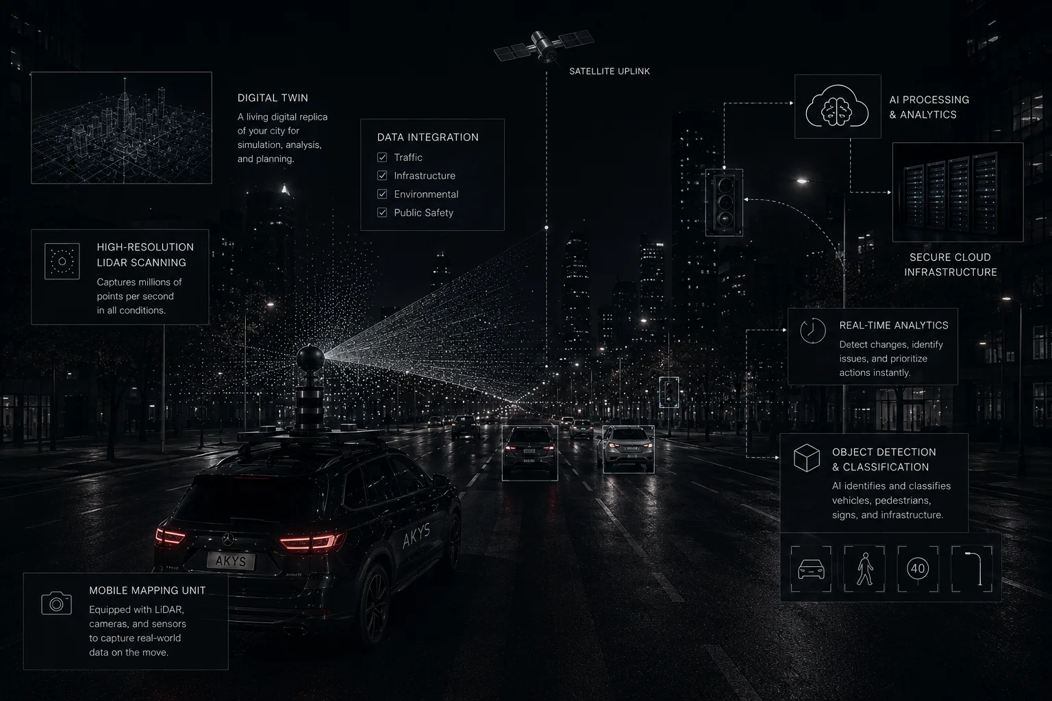
Our custom 'Capture Cannon' rig integrates the Insta360 Titan with dual high-density mobile LiDAR, thermal LWIR, and RTK-GNSS to digitize urban infrastructure with ±3cm precision.
Designed for smart cities, infrastructure management, digital mapping, road inspection, environmental monitoring, and autonomous mobility applications.
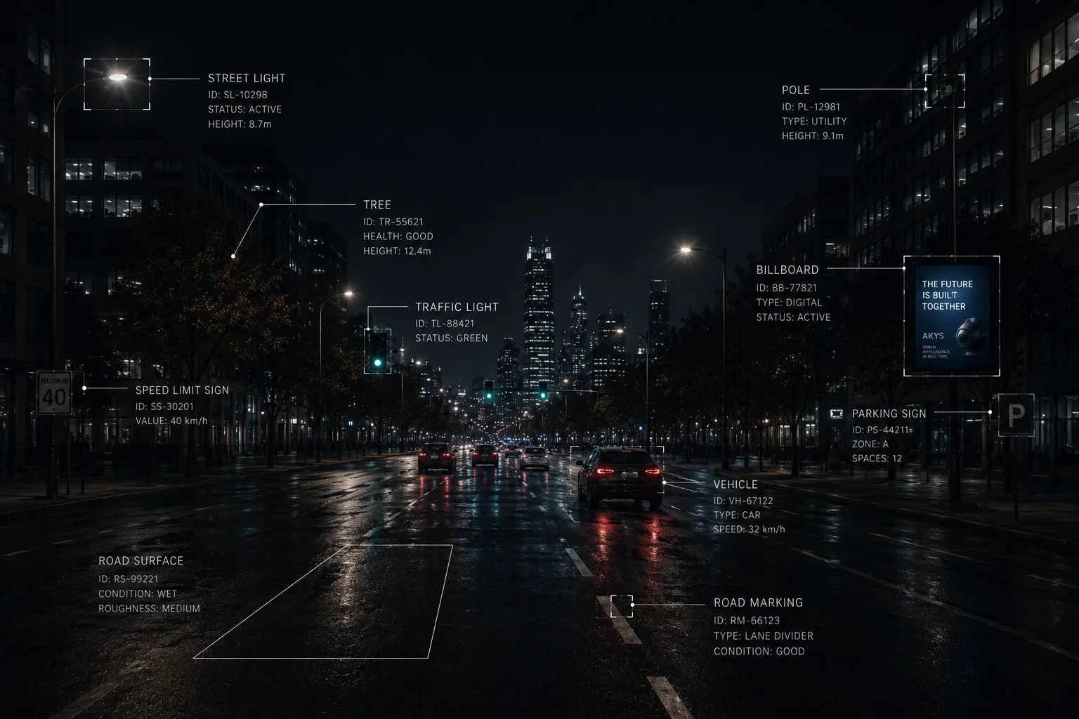
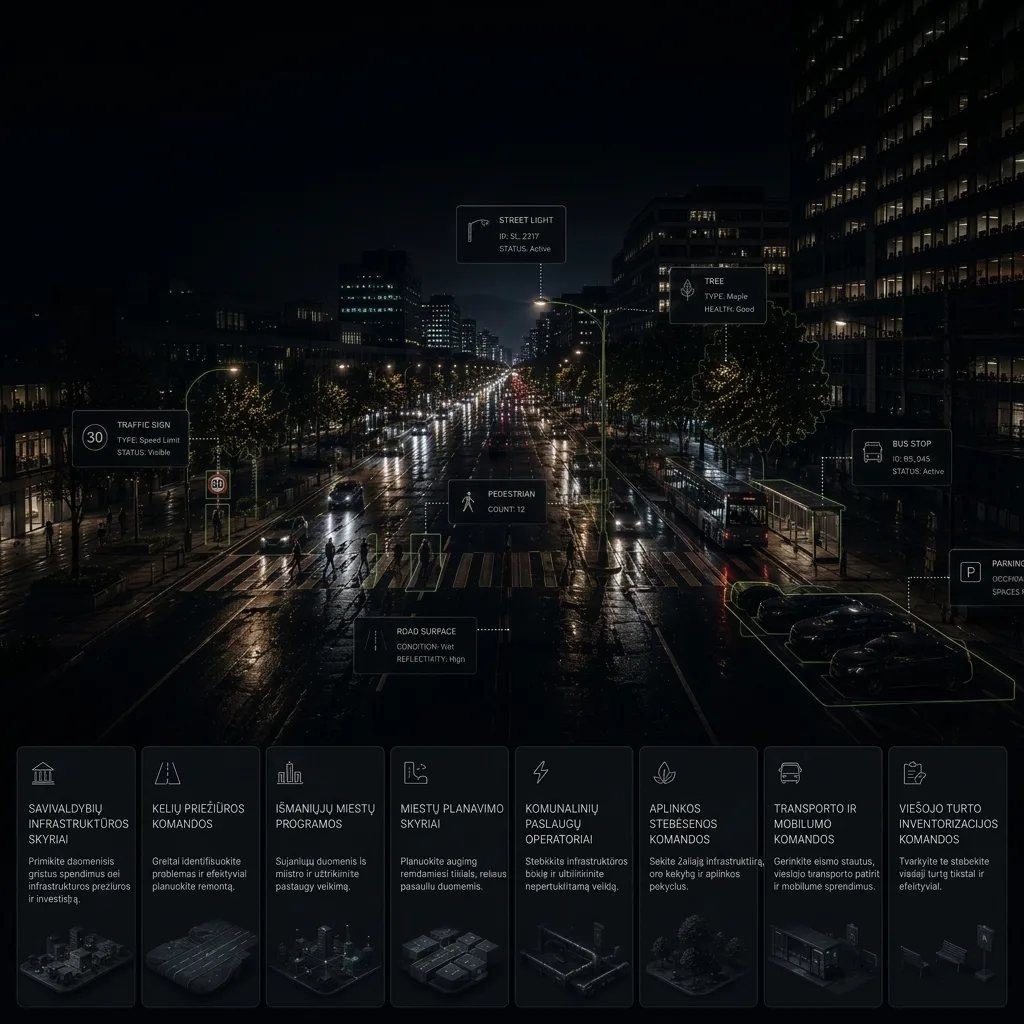
AKYS transforms 11K panoramas and LiDAR point clouds into structured urban intelligence using custom AI models trained for European road assets.
Built for smart cities, mobility analytics, infrastructure inspection, terrestrial digital twins, and autonomous systems.
We capture the city from the ground up, revealing what aerial imagery can't.
We build, train, and deploy AI models tailored to your specific infrastructure and city assets.
High-frequency mobile mapping creates a dynamic digital twin you can explore, measure, and trust.
We turn raw data into clean, trackable metrics to optimize maintenance schedules and improve urban mobility.
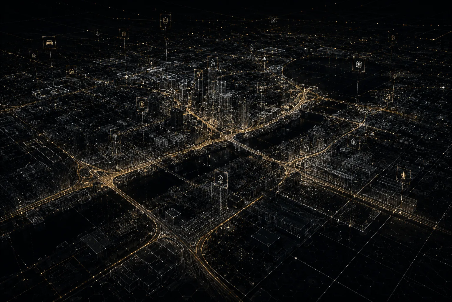
A standard map shows where a road is; a traditional 3D model shows what a building looks like. AKYS builds a semantic digital twin: a living virtual replica where every pixel and laser point knows its object, dimensions, and condition over time.
AKYS gives operational teams a shared, ground-level layer of truth for planning, maintenance, safety, and infrastructure investment.
At AKYS, we are a lean team of spatial engineers and developers on a mission to make the physical world completely queryable. We believe that managing a modern city shouldn't require expensive enterprise software licenses, outdated data archives, or heavy desktop installations.
By combining high-tech mobile sensors with our own automated AI processing pipelines, we deliver fresh, high-frequency digital twins directly to your web browser. We skip the corporate bureaucracy to give Baltic municipalities and utility leaders the instant, real-world clarity they need to build safer, smarter communities. We don't just map; we build the intelligent foundation for tomorrow's infrastructure.
Centimeter-level accuracy using dual LiDAR, RTK GPS, and high-frequency IMU sensors.
Fully automated AI blurring of faces and license plates before processing or storage.
Explore, measure, and analyze high-resolution digital twins directly in your web browser.
AKYS uses the Insta360 Titan for 11K 360-degree visual reality and dual high-density mobile LiDAR sensors synchronized with GNSS-RTK for centimeter-level accuracy.
An AKYS Digital Twin is a high-fidelity, georeferenced 3D model of an urban environment that combines 11K visual data with LiDAR point clouds and AI-detected infrastructure assets.
A tripod scanner captures from one fixed point and must be moved every few dozen metres, so scanning streets takes days. Our rig scans while driving at traffic speed, covering tens of kilometres of streets per day without closing roads, while holding ±3 cm accuracy through RTK-GNSS and a 6-axis IMU.
Custom-trained models detect and catalogue road signs, potholes, cracks and asphalt damage, faded or worn lane markings, utility poles, crosswalks, street lights and vegetation risk, each with GPS coordinates. Lane detection recovers lane geometry for a road lane defect audit, and semantic segmentation separates roads, pavements, buildings and vegetation. We also train custom models for the specific assets a city needs.
Yes. Faces and vehicle licence plates are automatically blurred by dedicated AI models before any data is stored or delivered, in line with EU GDPR.
3D point clouds in .las/.laz, 11K 360° panoramas, a browser-based digital twin, and an AI-generated infrastructure inventory as GeoJSON or CSV.
Book a pilot scan and discover what your streets are already telling you.